


Voting District 39B, Greene County, Missouri
About
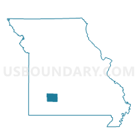
Outline

Summary
| Unique Area Identifier | 607873 |
| Name | Voting District 39B |
| County | Greene County |
| State | Missouri |
| Area (square miles) | 4.47 |
| Land Area (square miles) | 4.32 |
| Water Area (square miles) | 0.15 |
| % of Land Area | 96.58 |
| % of Water Area | 3.42 |
| Latitude of the Internal Point | 37.13293000 |
| Longtitude of the Internal Point | -93.23261000 |
Maps


Graphs
Select a template below for downloading or customizing gragh for Voting District 39B, Greene County, Missouri


Neighbors
Neighoring Voting District (by Name) Neighboring Voting District on the Map
- Voting District 11, Greene County, MO
- Voting District 32A, Greene County, MO
- Voting District 32B, Greene County, MO
- Voting District 32C, Greene County, MO
- Voting District 39C, Greene County, MO
- Voting District 41A, Greene County, MO
- CASSIDY Voting District, Christian County, MO
- CASSIDY 6 Voting District, Christian County, MO
- Clay B Voting District, Greene County, MO
- Clay C Voting District, Greene County, MO
- East Clay A Voting District, Greene County, MO
- RIVERSIDE Voting District, Christian County, MO
Top 10 Neighboring County Subdivision (by Population) Neighboring County Subdivision on the Map
- Springfield township, Greene County, MO (159,496)
- Cassidy township, Christian County, MO (7,639)
- Riverside township, Christian County, MO (6,773)
- Clay C township, Greene County, MO (3,396)
- Clay B township, Greene County, MO (1,795)
- East Clay A township, Greene County, MO (1,082)
Top 10 Neighboring Place (by Population) Neighboring Place on the Map
Top 10 Neighboring Unified School District (by Population) Neighboring Unified School District on the Map
- Springfield School District, MO (204,727)
- Ozark R-VI School District, MO (28,805)
- Greene County R-VIII School District, MO (12,679)
Top 10 Neighboring State Legislative District Lower Chamber (by Population) Neighboring State Legislative District Lower Chamber on the Map
- State House District 142, MO (47,928)
- State House District 135, MO (37,458)
- State House District 140, MO (36,171)
- State House District 138, MO (34,169)
Top 10 Neighboring State Legislative District Upper Chamber (by Population) Neighboring State Legislative District Upper Chamber on the Map
Top 10 Neighboring 111th Congressional District (by Population) Neighboring 111th Congressional District on the Map
Top 10 Neighboring Census Tract (by Population) Neighboring Census Tract on the Map
- Census Tract 203.06, Christian County, MO (7,370)
- Census Tract 38, Greene County, MO (7,268)
- Census Tract 203.05, Christian County, MO (6,011)
- Census Tract 25.02, Greene County, MO (5,104)
- Census Tract 26, Greene County, MO (4,804)
- Census Tract 40.03, Greene County, MO (4,711)
- Census Tract 40.02, Greene County, MO (3,583)
- Census Tract 39, Greene County, MO (2,709)